Patagonia is synonymous for the beautiful outdoors and the town of El Chalten is synonymous with hiking in Argentinian Patagonia. “El Chalten” means “the smoking mountain” in Tehuelche language and refers to Mt. Fitz Roy, the tallest peak in the region which is usually covered with clouds. The town is very young, founded in 1984 by Argentina, to boost its presence in the area. It is the basecamp for hikers and outdoor enthusiasts from all over the world. (See end of the post for list of popular hikes from El Chalten)
However, we had a small problem.
Neither of us is a hiker 🙂
And while we are ok to stretch ourselves physically to see some great views, hiking for the sake of hiking is not something we enjoy. In our first two years in Hong Kong, we had not done a single hike – despite Hong Kong having abundant trails and a hiking culture. But when we read about Patagonia, we figured it would be silly to visit and not hike there. So for practice, we started going on long walks in Hong Kong and hiked some of the more popular routes in Hong Kong – all in one month. Looking back, the HK hikes were hardly in the same league, but without them, we probably would not have managed the hikes in Patagonia.
Laguna Torre
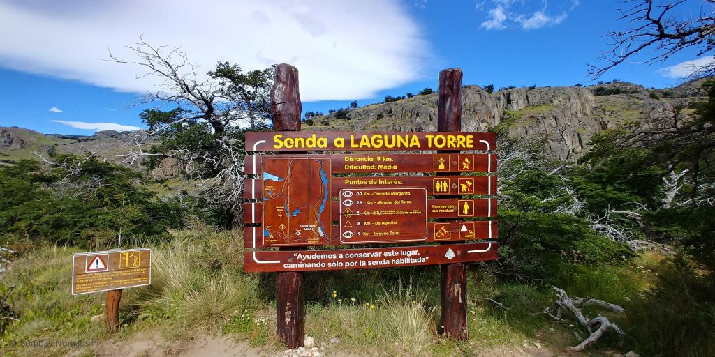
The Laguna Torre trek is one of the two most famous trails in El Chalten. The other one is the Laguna de Los Tres – both are 20+ km round trip. We had intended to do a smaller trek as a practice on the first day and then tackle Laguna Dos Tres the next day (did not occur to us to attempt two 20+ km hikes at any point during planning 🙂 ) We discussed with our hotel the previous evening, and they suggested a couple of smaller hikes, from which we selected Mirador del Torre, which is essentially the first 3km of the Laguna Torre hike.
On the day of the trek, a new receptionist greeted us and asked us our plans. When we told him our plans, he seemed a bit surprised and asked us to consider doing the full trek to Laguna Torre, as the first 3km is the difficult part of the hike. Although we werent sure about being able to do the full hike, we decided to take a call after the first 3 kms.
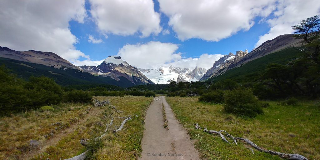
It wasn’t immediately clear which road out of town led to the start of the Laguna Torre trek – we took the most promising one. On Antonio Rojo street, we headed to the end of the road where a big black staircase with ramps is visible. After the stairs, on the left there is a trail climbing over a small hill. We followed the trail and at the top of the hill is a sign welcoming you to the Cerro Torre trail.
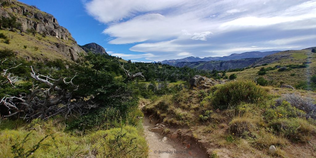
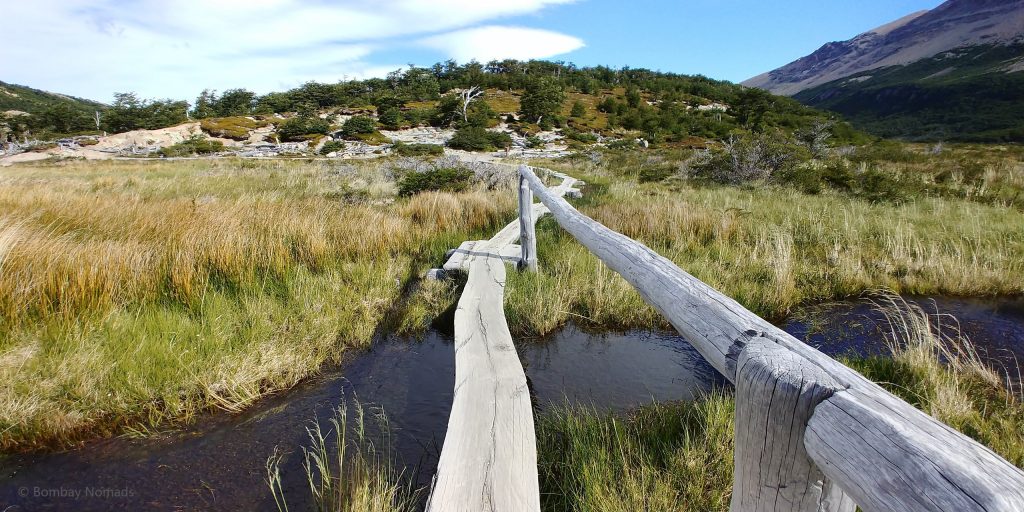
The path keeps climbing in stages, meandering through beautiful forests, meadows and hill slopes. While steep in some places, it is never murderous enough for you to question your resolve. The trail is clear and there are log bridges over small streams, as well as wooden logs as steps on the steeper sections. Also, there are sign posts every 1km telling you of your progress, and all we needed was to finish 3 of those.
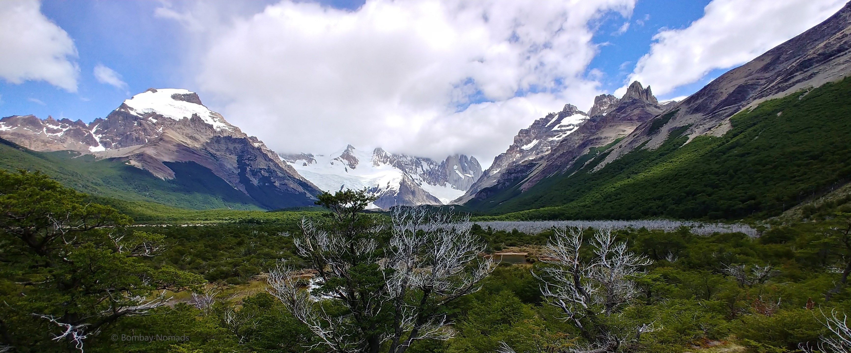
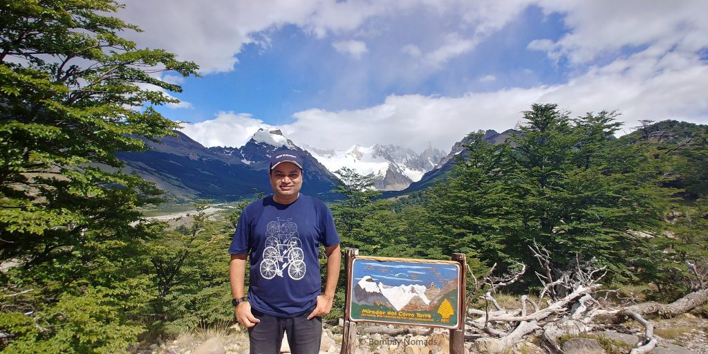
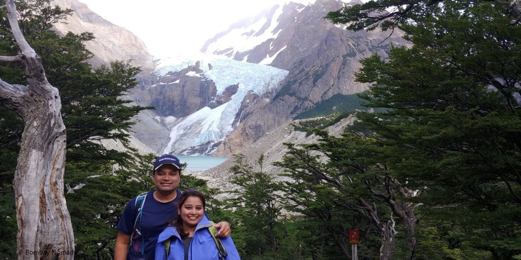
We kept taking numerous small breaks on the steeper sections, letting fitter people past. In a little under 2 hours, we crested a hill and there it was. A majestic view of Cerro Torre (Cerro is mountain in Spanish) spread out in front of us. From the mirador, we could see the snow-covered peaks and Cerro Torre in the middle, sticking up like a needle. The peak of Cerro Torre was covered by a bit of a cloud, but it looked different from its snow-covered neighbours, as the steep granite rock is completely free of snow. The weather was a pleasant 14-16 deg C and we were generating enough body heat to be comfortable in just our t-shirts.
There are a few wooden benches at the Mirador, for people to catch their breath and enjoy the views. We grabbed one of the benches and just drank in the view and ate a granola bar. We had struck up a conversation with an elderly Argentine couple, who had reached the Mirador before us. There is also a basic jungle toilet (shack with a hole in the ground, no water) at the Mirador.
Neither of us were very tired at that point and hiking the rest of the way to Laguna Torre began to seem like a realistic possibility. After gazing at the distant Cerro Torre, we decided it would be a shame to not go for the whole thing. It didn’t hurt to see that the elderly couple also went for the full hike.
(And that decision was one of the best we have taken in the trip. Finishing the Laguna Torre hike without killing ourselves, gave us all the confidence we needed to tackle the much harder Laguna de Los Tres and Base of Towers hikes in Torres del Paine)
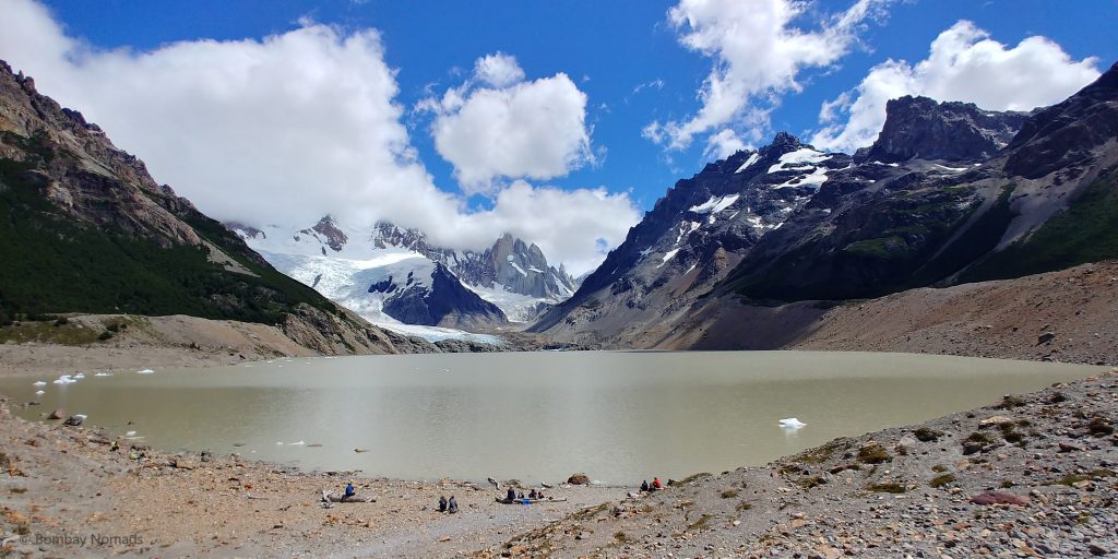
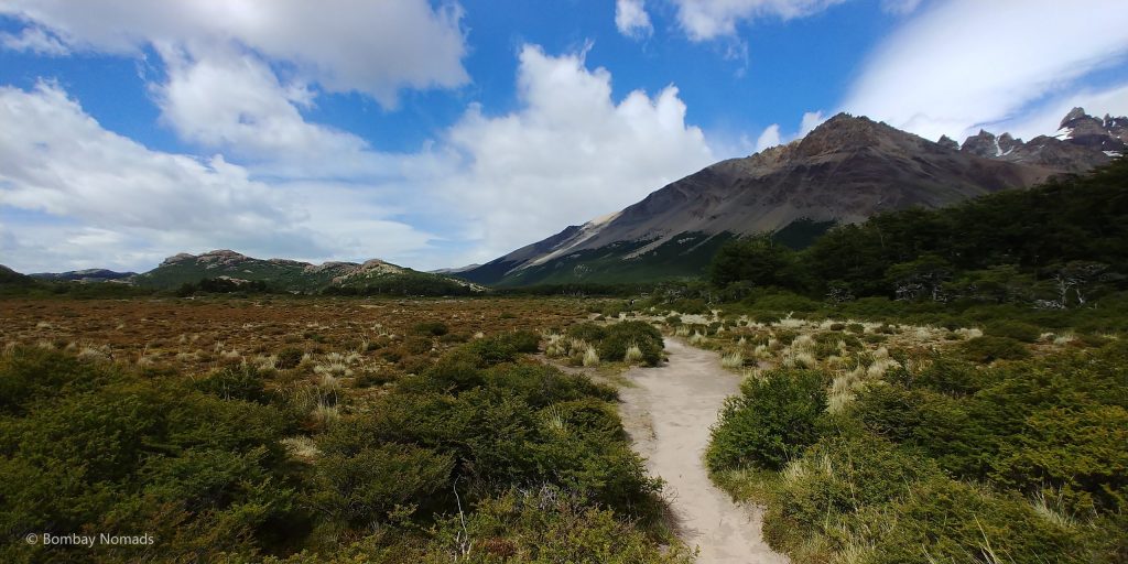
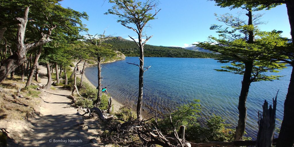
The trail from the Mirador onwards is a comfortable walk. Even though it is an additional 7km, it is almost flat all the way to the lake. The trail passes through forests of lenga trees for most of the way, before opening up into flatter scrubland. We crossed some small rivulets at places and overall it is an enchanting place to be. The last 200m from the campsite to the lake is a scramble up a skree-filled slope, but other than that, there is no real tough segment in the latter half of the trail.
The colour of the lake itself is a dirty greyish brown, although it is fed from a glacier coming down from Cerro Torre. There were a few small icebergs floating in the lake. The cloud still hung to Cerro Torre like a pest, blocking a clear view of the peak. But the slight disappointment aside, the weather was glorious, with blue skies and none of the notorious bad weather Patagonia is famous for.
The lake isn’t very big and the shore is strewn with boulders where trekkers had parked themselves, some even taking a nap. We found ourselves a comfortable rock and spent an hour at the lake, eating our packed lunch and going down to the waterline to take photos.
The way back to Mirador del Torre was again not difficult. We refilled our water bottles at a small rivulet close to the Laguna Torre campsite. From the Mirador, climbing down was a bit slow, as negotiating a downward slope on tired legs can be tricky. But in a cumulative time of 6:45 hours, we finished the 21km trek (not including 1 hour spent at the top). Given that official estimates are 3+3, we were quite proud of not being too far off the time sheets.
This was the first of our many hikes in Patagonia and it gave us a lot of confidence to attempt all the remaining hikes.
Lago del Desierto
The name translates to ‘Lake of the Desert’, though it isn’t clear why it got this name. The area surrounding the lake are filled with verdant forests. One theory is that there were no fish in the lake when it was discovered by Europeans. Since then, trout has been introduced in the lake and it is now a good fishing spot.
After the long hike to Laguna Torre the day before, we wanted to do something relaxing. The tour of Lago del Desierto sounded perfect because it involved a bus ride and then a boat ride in the lake – and hiking was optional. There aren’t too many non-hiking things to do in El Chalten, to be honest. There wasn’t a lot of information online about tour options to Lago del desierto and we were loathe to search for tour operators on foot after the hike. So we went with the our hotel option, even though we were probably paying a bit more. There were two departure options for the tour – 9:00 and 12:00 hours. We chose the 12:00 departure, so that we could sleep in late.
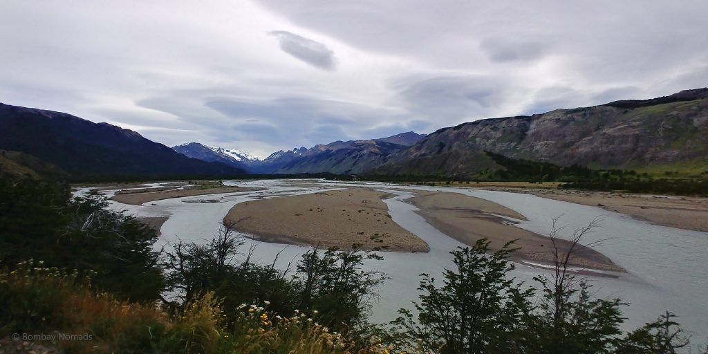
The bus picked us up at about 12:15, and the distance to the lake is about 40km. But Provincial Ruta 23 is unpaved and the going is slow – giving us more time to savour the beauty of the place. The route to Lago del Desierto is prettier than the lake itself – though the lake isn’t any slouch either. The road runs along Las Vueltas river for half the way, before crossing the Blanco river and then running alongside the Electrico river. Around midway is a beautiful lake Laguna del Condor. The bus stopped at one particular scenic point with a beautiful view of Mount Fitz Roy.
It took us 1.5 hours to reach the lake. The stop was for 2 hours. You could either do a 1 hour boat ride on the lake or you can climb to a viewpoint to get a better view of the Huemul glacier in a 1.5 hours round trip hike. We had no intention of hiking that day, so the boat ride was the only option. However, at the lake we found out that our boat had malfunctioned and there would be no boat ride. But there was a competitor who was ready to take us, for an inflated price of 900 pesos per head (original was 600 pesos). We decided to go ahead with the ride, especially since the new boat was much nicer than our original boat.
The boat ride was for 45 min and it was a pleasant ride around the lake – where we saw the Huemul & the Vespignani glaciers. The lake is not fully on the tourism map, so there are very few tourists. Our boat had a capacity of only 32 people – with 75% full on our ride – and from the signs we saw, it appeared to do only one ride a day. The boat ride doesn’t offer any really special vistas and can be skipped if you want to save on costs. After our boat ride, we ate our packed lunches on the shore of the lake. Then we hopped back on our bus and slept through most of our return journey home.
Once back in town, we had noticed one of the nearby restaurants ‘Mathilda’ having a ‘sushi night’ on Fridays. After the delicious sushi we had in El Calafate, we jumped at the chance of having sushi again. Unfortunately, the experience couldn’t have been more disappointing. Not only was there no wasabi, the rice used in the maki rolls was partially uncooked! We are no sushi connoisseurs, but uncooked rice is just not done. The sushi was served with soy sauce and some kind of pineapple chutney. Since Pradosh can eat almost anything, he finished his plate, while Suchi barely had any and ordered dinner again at the hotel restaurant.
Laguna de Los Tres
This hike was the toughest day in our trip so far! We managed to complete the Laguna de Los Tres hike, all 22 km of it, but we ourselves were completely finito by the end of it. Compared to this, Laguna Torre almost seemed like a walk in the park.
Laguna de los Tres refers to the azure glacial lake in front of Cerro Fitz Roy, which is the tallest peak in the region and somewhat of a talisman of the province. Like Cerro Torre, Fitz Roy is a granite spire that rears up sharply, and has no snow cover because of its steep slopes. It is also the logo of the Patagonia outdoor clothing company.
There are two ways to reach Mt Fitz Roy. The conventional route starts at the outskirts of the town of El Chalten itself. The other route starts from Hosteria Pilar, 17 km away from town. You take a shuttle bus to El Pilar and do the onward journey via that route. Then on the way back you take the conventional route so that you can just walk back into town. This has two advantages – seeing two different vistas instead of the same scenery both times and the upward route from Hosteria Pilar is supposed to avoid some of the climbing.
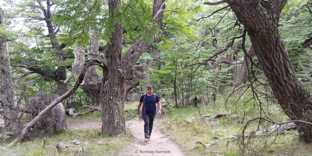
After finishing the hike, we are of the opinion that the climb isn’t lesser in the El Pilar route, it just comes later. In the town route, you start climbing from the first step itself and you keep climbing for the first 2 kilometres, which can seem a bit daunting. In the El Pilar route, the first couple of km are gentle trails through forests, before suddenly climbing steeply in the 3rd and 4th km. On hindsight, El Pilar is still the way to start the climb, because the steep sections are inside the forest, and hence a bit protected from the sun, which can be quite strong at times.
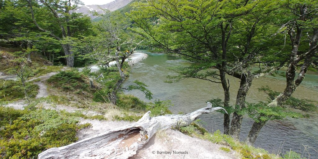
The Patagonian weather finally made an appearance on the day of our hike and it was dark, windy and cloudy when we started. Our shuttle pickup was at 08:00 and it cost 350 pesos per head. The shuttle did the usual rounds of different hostels and finally dropped us in El Pilar only at 08:50. The wind had gotten stronger and there was a small drizzle falling, but thankfully it petered off after 20-30 min. The hike from El Pilar meanders through the lenga forest, along the Blanco river and the trees shielded us from the worst of the elements. As mentioned before, the climb became quite steep from kilometres 3 onward.
About midway into the trail comes the Mirador (or viewpoint) for Piedras Blancas. We got a fabulous view of the Piedras Blancas glacier and the small glacial lake, across the Blanco river valley, unimpeded by any clouds. The view completely rejuvenated us and we carried on, even as the wind had increased to a howl. The entire forest seemed to be creaking and swaying, and we said silent prayers asking for branches to not fall on us. Our driver on the Lago del Desierto trip had told us that lenga trees fall very easily, because the topsoil in the region isn’t very deep.
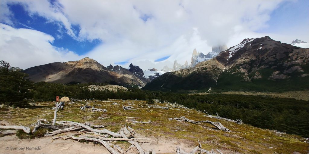
Since the Laguna de Los Tres trail is a popular one, we never felt really alone in the forest. We met people every 15-20 min. As we got closer to Camp Poincenot, we started seeing people who were coming in the opposite direction i.e. the town route. Just before reaching the camping ground, the forest gives away into an open shrubland and we got the first hint of what the last part of the trail was going to be like. It was a crazy steep trail seemingly going up the next hill vertically.
Camp Poincenot is a camping ground in the woods, with porta-loos and about 10-15 tents. Anyone wanting to see the sunrise at Fitzroy will have to stay overnight at Poincenot, as camping is only allowed in the designated camps. Once we crossed the camp, we crossed a couple of log bridges over the Rio Blanco river, which is just a tiny stream at this point. Beyond which lay the dreaded last segment of the trail began. Every person we spoke to and everything we had read on the internet mentioned that the last kilometre was a tough climb. But we had already seen from afar what an understatement the ‘toughness’ was.
There is a helpful board at Rio Blanco, stating that the climb is rigorous and one needs to be in good physical shape to complete it. Another board says it is 1 hour to the Laguna. After completing it, we can tell you that it is 2.5 km of almost vertical climbing from the Rio Blanco signpost. And for us, it took us almost 2.5 hours. To be fair, others also seemed to be struggling while going up. And then there were also the ones who seemed to stroll past us – two couples even took their infant babies to the top! Overall, I think the fitter people would take 1.5 hours to climb the last part and 2 hours was probably the average.
The trail itself is just a tumble of boulders from top to bottom. It switches back and forth while climbing, like a hilly road. In some places, the rocks have been placed like steps. In other places, it is just find-your-own-footing. There are yellow posts marking the trail everywhere, but a lot of places, there was no difference between the marked trail and the rest of the stones.
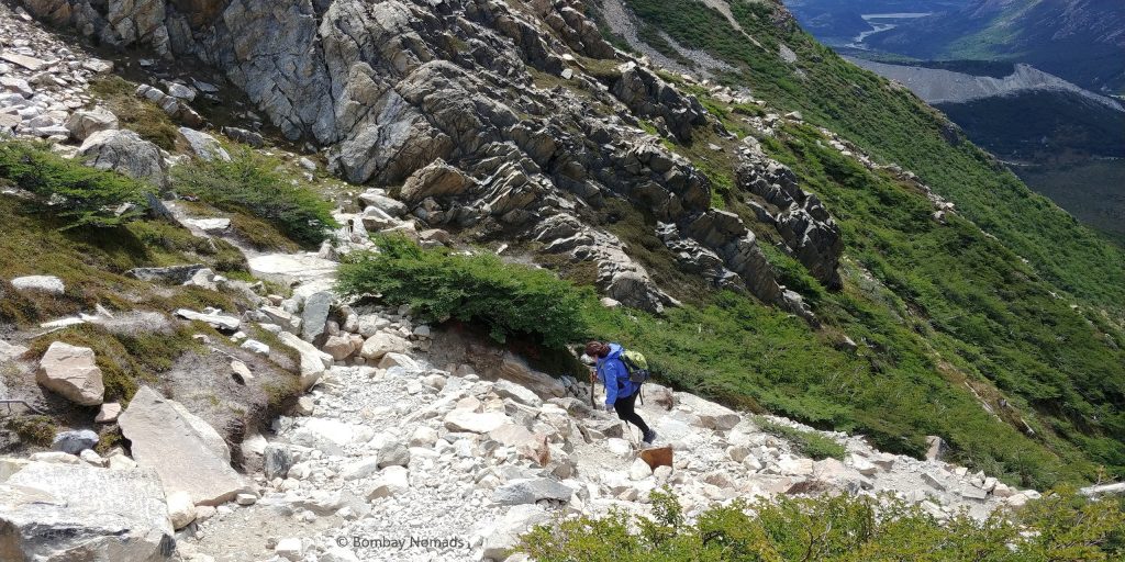
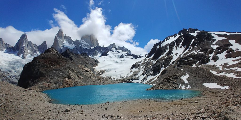
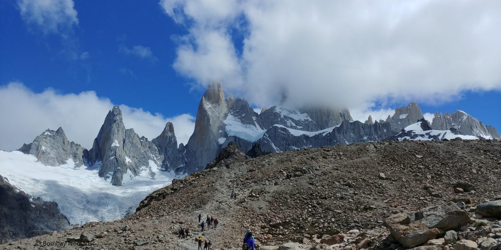
Wheezing and panting, we made it to what seemed like the crest, only to find that there existed another final challenge – a 300m skree (loose gravel) filled slope with no discernible trail. Everyone took whatever they thought was the trail. We negotiated this loose gravel and finally reached Laguna de Dos Tres. It was everything that was promised – a beautiful blue lake, with the photogenic Mt. Fitz Roy in the background, and neighbouring peaks covered with ice. The small imperfection being that the crown was still shrouded by clouds.
Completely spent, we plopped on the nearest rock we found and caught our breath. The wind was strong and we had to shelter behind our jackets as we took in the view and started eating our packed lunches. Half an hour after we reached there, the wind really started to pick up. We were being pelted with sand and grit and the gusts of wind were threatening to topple anyone who hadn’t planted their foot strongly. We waited for the gusts to pass, but gusts kept coming repeatedly.
We figured that it would be difficult to stand these crazy winds for long, especially after it dumped sand on all our food. So, we hurriedly took some photos and started on our return trip. Negotiating the skree slope was the toughest, as there was really no grip. Everyone was sliding and slipping, and quite a few people (including Suchitra) lost their footing and landed on their backside. However, there were no injuries and holding each other for stability, we negotiated this first test successfully.
Then we still had to negotiate the whole hill down to Rio Blanco river. We eventually managed to get back down in about 1.5 hours. It was now 17:00.
From Camp Poincenot, we turned right and started walking on the other trail, which would take us back to El Chalten. It was still 8+ km of hiking, and we were quite drained already. We refilled our bottles at Rio Blanco river, and the first km from the camp was really pretty, as the trail kissed and crisscrossed the Rio Blanco river and other streams. After that, the trail became more uninteresting and exhaustion started catching up.
Most of the return journey, we were walking mechanically, one foot leadenly following the other. Thank god for the long summer days, sunset was scheduled at 21:30, so we weren’t too worried about getting stranded in the National Park at night. There was a small deviation which took us past Laguna Capri and the attached camping ground. Laguna Capri is another blue glacial lake at about the halfway point in the trail. We found a ledge and took a 15 min break there, admiring the scene and getting refreshed.
Then we resumed our trudging, slowly counting down kilometres, till we started getting views of the Las Vueltas valley. It meant El Chalten was close, but we were still really high up in the hills and there was still 3 odd km left. Bit by bit, tired legs somehow found the ability to crunch those kilometres and at 21:00, we walked out of the National Park gates and into town. We had to walk an additional km to our hotel and as we walked in to our welcoming hotel, the sun finally dipped beyond the mountains.
We had another spare day after the Laguna de los Tres hike. We had planned to do one of the smaller hikes in the afternoon – either Chorillo del Salto (waterfall) or Mirador de los Condores. But it was a rained out day and we could not get any hiking done. However, we were thankful that we had three great weather days before that.
Useful information
- How to reach El Chalten:
- There are no direct flights to El Chalten. The nearest airport is El Calafate, which has direct flights from all major cities in Argentina – Buenos Aires, Bariloche, Cordoba, Trelew, Rio Grande and Ushuaia.
- From El Calafate, El Chalten is at a distance of ~200 km and there are regular buses by Caltur, TAQSA and Chalten Travel. Buses take between 3-3.5 hours. You can check bus timings on busbud.com, and book them in advance. You can also take private transfer/taxi or rent a car.
- A lot of travellers travel to Torres del Paine (Chile) from El Chalten and there are regular buses between El Calafate and Puerto Natales in Chile.
- Popular hikes in El Chalten (distances & times are for round trips):
- Laguna de los Tres – 22 km – 8-10 hours (Hard)
- Laguna Torre – 20 km – 6 hours (Medium)
- Laguna Capri – 8 km – 3.5 hours (Medium) – This comes en route Laguna de los Tres hike
- Mirador del Torre – 3 km – 3 hours (Medium) – This comes en route Laguna Torre hike
- Chorillo del Salto – 7 km – 3 hours (Easy). You also have the option of driving most of the way and walking only the last 1.5 km.
- Mirador de los Cóndores & Mirador Las Aquilas – 3 km – 2 hours (Easy)
- We highly recommend renting trekking poles from the shops in El Chalten. It is very helpful in negotiating tricky terrain, as we would discover later in Torres del Paine.
- The shuttle to El Pilar can be booked from your hotel and costs 350 pesos per head. There are two time slots for the shuttle – 06:00 and 08:00 hours. As it’s usually quite dark at 06:00, the one at 08:00 is the more popular one.
- Most hotels will also give you packed lunches that you can take on the hikes. You’ll have to inform them the previous day. The packed lunches usually include sandwiches / pies, fruits, juice and nutrition bar / cookies. Some of the eateries around town also offer packed lunches.
- The town of El Chalten is very small, touristy and with a population of just 1,500. It takes just 10-15 min to cross the town by walking. There are lot of similar restaurants offering combinations of burgers, pizzas, sandwiches and wraps, including a couple of vegan restaurants. We did not think any place was particularly outstanding.
- We stayed at Chalten Suites. The rooms were comfy and spacious, but not worth USD 275 per night we paid. Hotel Destino Sur is the other expensive hotel in El Chalten. There wasn’t much difference in price and facilities between the two hotels. That is not to say cheaper options were not available, we just wanted a comfier option to recover from the long hikes.
- We noticed a single spa in the area – Spa Yaten. It was heavily booked, as spa treatments are understandably popular after the long hikes. They have fewer manual massages and more machines – jacuzzies, massage chairs/beds etc. We visited the spa on our spare day after the Laguna de Los Tres trek. All their manual massages were booked out, so we chose the cold Criogel treatment to help our legs recover. It involved wrapping legs with ice-soaked towels and did not seem to significantly help our tired muscles. Maybe it would have been more useful directly after the trek.